Industry-specific use cases

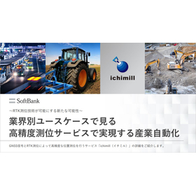
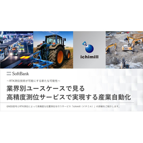
Industrial automation realized by high-precision positioning services seen through industry-specific use cases.
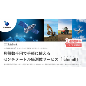
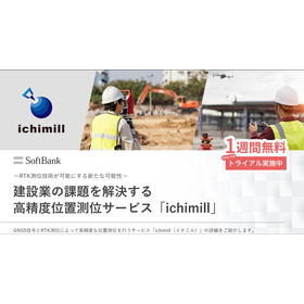
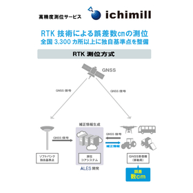
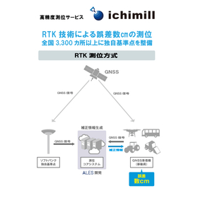
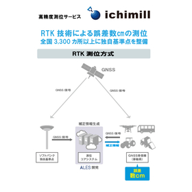
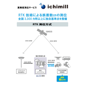
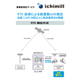
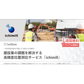
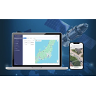
The paradigm shift in industrial structure is advancing the automation of various industries. In this context, high-precision location information is gaining attention. In automation, discrepancies in location information can reduce the reliability of collected data and lead to causes of operational errors, making it essential to capture accurate time and place for the development of industries. This document provides a detailed introduction to the service ichimill, which enables positioning with an accuracy of a few centimeters by performing RTK positioning using signals received from GNSS such as the quasi-zenith satellite Michibiki. Additionally, we will present industry-specific use cases demonstrating how ichimill is being utilized across various sectors.
basic information
"Features of 'ichimill'" ■ No need for customers to set up or maintain reference points ■ Compatible with multiple GNSS (including the quasi-zenith satellite "Michibiki" and five other satellites) ■ Affordable and available for spot use (monthly or annual contracts can be chosen) ■ With densely installed reference points, wide-area movement can be smoothly connected via handover※2 (in the case of Ntrip method, handover can be turned off by selecting the mount point)
Price range
Delivery Time
Applications/Examples of results
【Agriculture】 Realizing smart agriculture through the automation of agricultural machinery (Shikaoi Town, Hokkaido) 【Construction】 Achieving high-precision 3D surveying essential for BIM/CIM 【Public Surveying】 Adopting RTK-GNSS (VRS method) based on the guidelines of public surveying work established by the Ministry of Land, Infrastructure, Transport and Tourism 【Surveying】 Reducing surveying labor through the combination of drones and "ichimill" Enabling accurate geodesy and surveying without the installation of reference stations 【Infrastructure Monitoring】 Achieving efficiency in monitoring operations through the acquisition of high-precision location information 【Inspection】 Enhancing inspection efficiency through high-precision drone control 【Traffic】 Realizing autonomous driving through the acquisition of high-precision location information
catalog(1)
Download All Catalogs
News about this product(2)
-
Nakanoshima Robot Challenge 2023 Report: The Present and Future of Robot Autonomous Movement through High-Precision Satellite Positioning
On January 28, 2024, the main running event of the outdoor autonomous mobile robot demonstration experiment "Nakanoshima Robot Challenge" was held at Nakanoshima Park in Osaka City. The "Nakanoshima Robot Challenge" is conducted as part of technology development aimed at the practical application of autonomous mobile robots, providing a public experimental platform for universities and companies. Participants tested their skills towards the realization of "automatic garbage collection robots," aiming for a demonstration at the 2025 World Expo. SoftBank and ALES (a company established through joint investment by SoftBank and Enable, Inc.) have participated as sponsors of this event since 2020, providing technical support related to robot positioning, correction information for the centimeter-level positioning service "ichimill," and lending specialized terminals. This article will introduce the event's proceedings and the autonomous movement control of robots using high-precision location information.
-
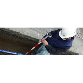
Enabling the detection of water pipe joint positions with an error margin of a few centimeters. Achieving the digitalization of piping construction management through the utilization of location information.
Currently, the construction and infrastructure industry is facing serious issues such as a shortage of personnel and an aging workforce. The water supply, which is the most important infrastructure supporting our lives, is also confronted with various challenges, including the aging of facilities, a decrease in the number of staff, and an aging workforce among contractors. To maintain and manage water supply facilities, improving efficiency on-site is more essential than ever. To address this issue, Nishio Rent All, a construction equipment rental company, has developed the "HAIKAN-SmartWork" piping construction information management system, which allows for the identification and management of the location of buried water pipes based on signals received from GNSS.
Distributors

Support for Corporate DX Providing the four foundations necessary for digitalization 1. Communication Improvement of the work environment / Cloud-based information / Robust network communication 2. Automation Automation of routine tasks / Creation of workforce / Productivity enhancement 3. Marketing Data collection and integration / Analysis and visualization of customer profiles / Advertising distribution and effectiveness measurement 4. Security Building secure networks / Latest malware countermeasures / Utilization of secure cloud services