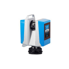
Measurement Specialized Machine "AeroBo (AS-MC03)"
A higher level of precision that meets on-site needs, along with its overwhelming ease of use!
The "AeroBo (AS-MC03)" is a surveying specialized drone that completes automatic measurements simply by setting the area, overlap, and altitude. It is fully controlled by a high-sensitivity large-format sensor through an edge computer. By supporting GeoTag embedding into EXIF, it achieves high speed and high precision, and when combined with AeroBo Cloud, it realizes industry-leading analysis speed. 【Features】 ■ Easy operation for peace of mind on-site ■ AeroBo Surveying 2.0 ■ Enlarged GPS antenna to improve reception sensitivity and enhance positional accuracy ■ Support for maintenance by manufacturers necessary for industrial use ■ Dustproof and waterproof design *For more details, please refer to the PDF materials or feel free to contact us.
basic information
【Other Features】 - Safety design incorporating experiences from thousands of various sites into our own enclosures and flight controllers. - Improved reliability through the incorporation of multiple sensors such as inertial and geomagnetic sensors. - Enhanced reliability of satellite capture in Japan with the reception of quasi-zenith satellite QZSS. - Stable automatic takeoff and landing using downward distance measuring sensors. - Increased strength of frame connection parts through new adhesive technology using CFRP and aluminum. - Flight log function for potential accidents. *For more details, please refer to the PDF document or feel free to contact us.
Price range
Delivery Time
Applications/Examples of results
For more details, please refer to the PDF document or feel free to contact us.
catalog(4)
Download All CatalogsNews about this product(2)
-

[Special Report] AeroSense's Photogrammetry Support Campaign
We are holding a photogrammetry support campaign for AeroSense products available at our company. During the campaign from December 2022 to the end of March 2023, customers who purchase five or more AeroBo markers will receive the following three major benefits: 1. One additional "AeroBo Marker" as a gift 2. A tripod adapter for each purchased unit (for AeroBo markers) 3. A three-month free ticket for "AeroBo Cloud" The AeroBo markers are effective as aerial markers for photogrammetry, and having more markers allows for more efficient work in benchmark surveying. Why not take this opportunity to start new photogrammetry and benchmark surveying with the 2nd class GNSS receiver from the Geospatial Information Authority of Japan? *For more details, please contact us or check the product information.
-

[Public Announcement] Surveying-Specialized Aircraft 'AeroBo (AS-MC03)'
We are pleased to announce that our surveying specialized aircraft, "AEROBOT (AS-MC03)," has been newly published on the Ipros page. This product can complete surveying automatically by simply setting the area, overlap, and altitude. You can download detailed product information and the catalog from the "Related Products" section. If you are facing any issues with surveying specialized aircraft, please take a look and feel free to contact us.
Distributors
Yokohama Measuring Instruments Co., Ltd. is engaged in the sale, repair maintenance, and rental of surveying instruments (general surveying instruments, GNSS, laser scanners, etc.), surveying CAD software, multifunction office equipment, and other related products. We offer a lineup of products from various manufacturers such as Leica, Topcon Sokkia, and Pentax. Please feel free to contact us if you have any requests. We have established a new consulting division to support subsidy applications. We provide support for subsidy applications such as the "Monozukuri Subsidy" and the "Business Restructuring Subsidy." We also offer support for the introduction of high-value equipment utilizing subsidies! Our company will comprehensively support the necessary business plans and application procedures required for the application. If you have any other questions, please do not hesitate to let us know.


