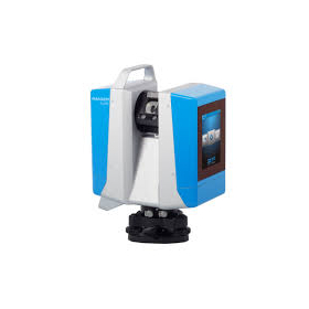
Leica Geosystems' 3D Laser Scanner 'BLK360'
Lightweight and compact for easy portability! High-speed scanning of up to 360,000 points per second with simple operation.
The BLK360 is a 3D laser scanner manufactured by Leica Geosystems that allows you to start scanning immediately by simply pressing a button on the device. Weighing just 1 kg, it is very lightweight and compact, making it easy to transport to job sites. With a scanning speed of up to 360,000 points per second, it can measure distances of up to 60 meters. The acquisition of HDR images, thermal images, and point cloud data, as well as streaming to an iPad Pro, is completed in just 3 minutes, significantly improving the efficiency of measurement tasks. For more details, please refer to the product catalog. 【Features】 - Lightweight, compact, and affordable 3D laser scanner - Easy operation with just a button press - Standard thermal camera included. Uses Class 1 invisible laser ★ We provide comprehensive support for the application process for manufacturing subsidies in collaboration with specialized consultants. Please feel free to contact us for more details. ★ Our company offers a variety of surveying instruments and systems, allowing us to make proposals tailored to your needs. For examples of products we handle, please refer to the basic information section.
basic information
【Examples of Other Products】 <3D Laser Scanner "ScanStation P30/P40"> Measurement distance up to 270m. Capable of measuring 1 million points per second. <Drone Aerial Marker "AeroBo Marker"> Enables centimeter-level drone surveying simply by placing it at reference and verification points. <Large-Scale Point Cloud Editing Tool "Wing Earth 2020"> Supports loading and high-speed display of large-scale point clouds, automatic object recognition, edge extraction, and more. <Electronic Tablet and Surveying CAD System "WingNeo INFINITY 2021"> Compatible with both field surveying tasks and office editing tasks. *For more details, please refer to the materials. Feel free to contact us as well.
Price range
Delivery Time
Applications/Examples of results
*For more details, please refer to the materials. Feel free to contact us as well.*
Related Videos
catalog(12)
Download All Catalogs
Distributors
Yokohama Measuring Instruments Co., Ltd. is engaged in the sale, repair maintenance, and rental of surveying instruments (general surveying instruments, GNSS, laser scanners, etc.), surveying CAD software, multifunction office equipment, and other related products. We offer a lineup of products from various manufacturers such as Leica, Topcon Sokkia, and Pentax. Please feel free to contact us if you have any requests. We have established a new consulting division to support subsidy applications. We provide support for subsidy applications such as the "Monozukuri Subsidy" and the "Business Restructuring Subsidy." We also offer support for the introduction of high-value equipment utilizing subsidies! Our company will comprehensively support the necessary business plans and application procedures required for the application. If you have any other questions, please do not hesitate to let us know.


