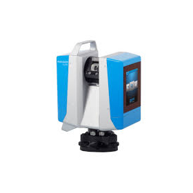
SLAM technology Mobile handheld laser scanner BLK2GO
While walking through the space, you can scan large buildings, structures, and environments at an unprecedented speed and with ease.
The BLK2GO performs millions of high-precision measurements simply by pressing a button to power it on and walking around, recreating the surrounding space in 3D. The data from the BLK2GO serves as the foundational data for accurate floor plans, BIM models, and 3D visualizations. With a scanning speed of up to 420,000 points per second, it can measure up to 25 meters away. 【Features】 ■ Lightweight, compact, and affordable 3D laser scanner ■ Easy operation with just a button press ■ Rechargeable battery allows for continuous scanning for 45 minutes ★ We provide comprehensive support for the application process for manufacturing subsidies in collaboration with specialized consultants. Please feel free to contact us for more details. ★ Our company offers a variety of surveying equipment and systems, allowing us to make proposals tailored to your needs. Please refer to the basic information section for examples of our products.
basic information
【Examples of Other Products】 <3D Laser Scanner "ScanStation P30/P40"> Measurement distance up to 270m. Capable of measuring 1 million points per second. <Drone Aerial Marker "AeroBo Marker"> Enables centimeter-level drone surveying simply by placing it at reference and verification points. <Large-Scale Point Cloud Editing Tool "Wing Earth 2020"> Supports loading and high-speed display of large-scale point clouds, automatic object recognition, edge extraction, and more. <Electronic Tablet and Surveying CAD System "WingNeo INFINITY 2021"> Compatible with both field surveying tasks and office editing tasks. *For more details, please refer to the materials. Feel free to contact us with any inquiries.
Price range
Delivery Time
Model number/Brand name
Leica BLK2GO
Applications/Examples of results
*For more details, please refer to the materials. Feel free to contact us as well.*
Related Videos
catalog(15)
Download All Catalogs

News about this product(8)
-

We will exhibit at the 7th Construction and Surveying Productivity Improvement Expo (CSPI-EXPO 2025)!
We are pleased to announce our participation in the 7th Construction and Surveying Productivity Improvement Expo (CSPI-EXPO 2025). We will be demonstrating remote surveying using GNSS and electronic leveling instruments, as well as providing consulting on the introduction of equipment utilizing subsidies! Please feel free to stop by our booth. 【Exhibition Content】 - Remote operation of surveying equipment - Consulting on the introduction of equipment utilizing subsidies - Viewing point cloud worlds in VR and more Venue: Makuhari Messe Halls 1-6, Outdoor Exhibition Area, Outdoor Exhibition Area ANNEX Dates: June 18 (Wed), 19 (Thu), 20 (Fri), 21 (Sat), 2025, 10:00 AM - 5:00 PM [Only on the final day, June 24, until 4:00 PM] Booth Location: Exhibition Hall 6, 17-24
-

[Free Consultation] 19th Manufacturing Subsidy
The 19th Monozukuri Subsidy application has started. 【Schedule】 Application Start Date: February 14, 2025 (Friday) Application Deadline: April 11, 2025 (Friday) 17:00 Announcement of Adoption: Scheduled for late July 2025 【Overview】 Maximum Subsidy Amount: Up to 25 million yen (with upper limit increase measures*) Subsidy Rate: 1/2 for small and medium-sized enterprises, 2/3 for small enterprises, small business operators, and revitalization businesses *For small and medium-sized enterprises that fall under the special case of minimum wage increase: 2/3 <Eligible Expenses for Subsidy> Costs for machinery and equipment, system construction (mandatory), technology introduction costs, expert fees, transportation costs, cloud service usage fees, raw material costs, outsourcing costs, and related expenses for intellectual property rights, etc. Our company specializes in subsidy applications for construction machinery and surveying equipment, with an adoption rate of over 90%. If you are considering applying for a subsidy, we also offer free consultations!
-

[New Service] '3D Measurement Service' utilizing ground-based laser scanners.
We can acquire 3D point cloud data using our terrestrial and handheld laser scanners. Additionally, we offer GNSS surveying services and can accommodate requests for RTK surveying and static surveying as needed! 【Features of 3D Measurement Services】 - Smooth support from meetings to the field - Delivery of 3D point cloud data in the requested data format - Data delivery within as little as 2 business days* (Delivery time may vary depending on the size of the site.) 【Main Equipment Used】 - Leica RTC360 - Leica BLK G2 - Leica BLK 2GO - Leica GS18 I - Leica GS18 T - Leica GS07 We have a proven track record in various scenes such as roads and fields. Please feel free to consult with us!
-

We will be exhibiting at the 6th Construction and Surveying Productivity Improvement Exhibition (CSPI-EXPO 2024)!
We are pleased to announce our participation in the 6th Construction and Surveying Productivity Improvement Expo (CSPI-EXPO 2024). We will provide explanations on remote operation of total stations and consulting for equipment introduction utilizing subsidies! Please feel free to stop by our booth. 【Exhibition Content】 - Remote operation of total stations - Consulting for equipment introduction utilizing subsidies and more Venue: Makuhari Messe Halls 1-6, Outdoor Exhibition Area, Outdoor Exhibition Area ANNEX Dates: May 22 (Wed), 23 (Thu), and 24 (Fri), 2024, from 10:00 to 17:00 [until 16:00 on the final day, May 24] Booth Location: Exhibition Hall 4, 11-51
-

【Latest Information】Wingneo INFINITY 2025 Sales Start
Our company’s partner, Aisan Technology, has announced the release of "Wingneo INFINITY 2025." We have achieved system enhancements and updates that link observation instruments smartly to support observation, editing, and results in the new digital era of surveying. 【New Features and Updates】 - Improved electronic tablet command display and expanded functionality - Enhanced collaboration with the large-scale 3D high-speed point cloud editing tool "WingEarth" - Expanded raster engine functionality - Compliance with the March 2023 version of the public surveying work regulations - Compliance with the March 2023 version of cadastral surveying examples (ground method version) - Compliance with the March 2023 version of the Ministry of Land, Infrastructure, Transport and Tourism's electronic delivery guidelines and standards for civil engineering design work - LasPort integration - Additionally, some requests from our customers using our products have been reflected in the new features.
Distributors
Yokohama Measuring Instruments Co., Ltd. is engaged in the sale, repair maintenance, and rental of surveying instruments (general surveying instruments, GNSS, laser scanners, etc.), surveying CAD software, multifunction office equipment, and other related products. We offer a lineup of products from various manufacturers such as Leica, Topcon Sokkia, and Pentax. Please feel free to contact us if you have any requests. We have established a new consulting division to support subsidy applications. We provide support for subsidy applications such as the "Monozukuri Subsidy" and the "Business Restructuring Subsidy." We also offer support for the introduction of high-value equipment utilizing subsidies! Our company will comprehensively support the necessary business plans and application procedures required for the application. If you have any other questions, please do not hesitate to let us know.


