Point cloud tracing and analysis software "Pythagoras"

Software that efficiently creates floor plans by integrating 2D/3D CAD, point cloud analysis, and GIS.
Equipped with numerous features to enhance work efficiency, such as automatic image tracing and automatic point cloud tracing functions. It is suitable for tasks involving point clouds and 3D data in surveying, civil engineering design, construction, dredging, and consulting. 【Features】 ■ Automatically classifies point clouds into ground and non-ground, allowing for color coding, visibility toggling, and deletion for each category. ■ Reads edges and lines from images and automatically draws FDG lines. ■ Automatically traces edges and lines of point clouds, enabling quick conversion of 3D data into 3D models or cross-sectional views. ■ Easy color switching for point clouds and TIN, as well as coloring based on height or numerical values. ■ Capable of creating surfaces with Z values in 2D and simple 3D structures. *For more details, please refer to the PDF document. ★ This product is a surveying instrument eligible for "subsidy utilization" upon purchase. It may be available for purchase at 1/2 to 1/3 of the regular price! If you are interested, please feel free to contact us.
basic information
【Other Features】 ■ Automatic point cloud classification ■ Image and automatic tracing function ■ Prediction of landslide disasters from point cloud and TIN data ■ Output CAD drawings to Google Earth, creation of TIN models from point clouds and CAD points, TIN surface area calculation, TIN density adjustment, contour lines, gradient lines, and output in Landxml format are possible. *For more details, please refer to the PDF document or feel free to contact us.
Price range
Delivery Time
Applications/Examples of results
For more details, please refer to the PDF document or feel free to contact us.
catalog(22)
Download All Catalogs


Distributors

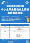
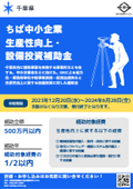
Yokohama Measuring Instruments Co., Ltd. is engaged in the sale, repair maintenance, and rental of surveying instruments (general surveying instruments, GNSS, laser scanners, etc.), surveying CAD software, multifunction office equipment, and other related products. We offer a lineup of products from various manufacturers such as Leica, Topcon Sokkia, and Pentax. Please feel free to contact us if you have any requests. We have established a new consulting division to support subsidy applications. We provide support for subsidy applications such as the "Monozukuri Subsidy" and the "Business Restructuring Subsidy." We also offer support for the introduction of high-value equipment utilizing subsidies! Our company will comprehensively support the necessary business plans and application procedures required for the application. If you have any other questions, please do not hesitate to let us know.


