"LupoScan," specialized in structured laser scan data processing.

Software that efficiently creates floor plans by integrating 2D/3D CAD, point cloud analysis, and GIS.
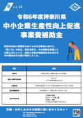
The laser scan data can easily and efficiently extract the required information and is equipped with an interface for CAD. Additionally, it is possible to send data directly, allowing for easy flat development of tunnels using the expansion function. ★This product is a surveying instrument that can utilize "subsidies" upon purchase. It may be available for purchase at a price of 1/2 to 1/3 of the regular price! If you are interested, please feel free to contact us.
basic information
**Features** - Compatible with various laser scanners, allowing data from multiple sources to be imported into a single project. - Registration function enables integration of laser scan data from different companies. - Display of panoramic images with reflectance intensity, RGB, spotlight, and distance. - 3D mesh creation allows for complex shapes to be converted into 3D meshes from structured data. - Interactive tools for creating CAD data and inserting text. - Cross-section creation function with customizable intervals. - Adjustment solid function enables easy model creation using data. - Plane unfolding function streamlines the creation of crack drawings from tunnel data. *For more details, please refer to the PDF materials or feel free to contact us.*
Price range
Delivery Time
Applications/Examples of results
For more details, please refer to the PDF document or feel free to contact us.
catalog(22)
Download All Catalogs


Distributors

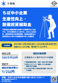
Yokohama Measuring Instruments Co., Ltd. is engaged in the sale, repair maintenance, and rental of surveying instruments (general surveying instruments, GNSS, laser scanners, etc.), surveying CAD software, multifunction office equipment, and other related products. We offer a lineup of products from various manufacturers such as Leica, Topcon Sokkia, and Pentax. Please feel free to contact us if you have any requests. We have established a new consulting division to support subsidy applications. We provide support for subsidy applications such as the "Monozukuri Subsidy" and the "Business Restructuring Subsidy." We also offer support for the introduction of high-value equipment utilizing subsidies! Our company will comprehensively support the necessary business plans and application procedures required for the application. If you have any other questions, please do not hesitate to let us know.


