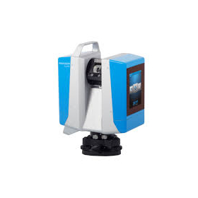
Mobile Handheld Scanner HS-X1

A handheld LiDAR scanner equipped with GNSS receivers and SLAM technology, capable of acquiring high-precision point cloud data both indoors and outdoors.
Make point clouds more "accessible" and "familiar" on-site! How about an entry-level 3D scanner?
basic information
■Main Specifications Lightweight and Compact Design: Body weight approximately 700g, including grip and battery about 1.05kg Absolute Accuracy ≦5cm Relative Accuracy ≦1cm Wide Range Scanning: Maximum measurement distance of 70m, horizontal 360°, vertical field of view from -7° to 52° Acquired data can be recorded using the included network RTK or GCP positions. High-Performance Camera: 2 units of 1-inch ultra-wide-angle cameras, 16 million pixels Long Operating Time: Continuous use for up to 2.5 hours Dust and Water Resistance: IP5X compliant Real-Time Display: Immediate confirmation of acquired point clouds via the dedicated app "Capture" Diverse Output Formats: Supports LAS, PLY, and PCD formats Dedicated Software: "PointClouds Studio"
Price range
Delivery Time
Model number/Brand name
PENTAX 「HS-X1」
Applications/Examples of results
In measurements within hard-to-access areas such as fences and the edges of central reservations, photogrammetry functions and laser distance meters can be used to measure points from a distance. This expands the scope of work beyond that of a standard GNSS receiver.
catalog(6)
Download All Catalogs


Distributors

Yokohama Measuring Instruments Co., Ltd. is engaged in the sale, repair maintenance, and rental of surveying instruments (general surveying instruments, GNSS, laser scanners, etc.), surveying CAD software, multifunction office equipment, and other related products. We offer a lineup of products from various manufacturers such as Leica, Topcon Sokkia, and Pentax. Please feel free to contact us if you have any requests. We have established a new consulting division to support subsidy applications. We provide support for subsidy applications such as the "Monozukuri Subsidy" and the "Business Restructuring Subsidy." We also offer support for the introduction of high-value equipment utilizing subsidies! Our company will comprehensively support the necessary business plans and application procedures required for the application. If you have any other questions, please do not hesitate to let us know.