news list

1~3 item / All 3 items
-
What is GNSS? Let's learn about the satellite positioning system that supports a highly functional and safe social environment.
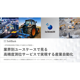
Displays the optimal route for smartphones and car navigation systems. Such functions utilize the satellite positioning system known as GPS. The satellite positioning system is also used for services such as flying drones for safety inspections of social infrastructure and delivering packages to homes, which means multiple satellite positioning systems are employed according to their intended use and positioning accuracy. In this article, let's deepen our understanding of the satellite positioning systems that support a safe, secure, and convenient social environment. Related materials: Industry-specific use cases for high-precision positioning services that enable industrial automation.
-
Nakanoshima Robot Challenge 2023 Report: The Present and Future of Robot Autonomous Movement through High-Precision Satellite Positioning
On January 28, 2024, the main running event of the outdoor autonomous mobile robot demonstration experiment "Nakanoshima Robot Challenge" was held at Nakanoshima Park in Osaka City. The "Nakanoshima Robot Challenge" is conducted as part of technology development aimed at the practical application of autonomous mobile robots, providing a public experimental platform for universities and companies. Participants tested their skills towards the realization of "automatic garbage collection robots," aiming for a demonstration at the 2025 World Expo. SoftBank and ALES (a company established through joint investment by SoftBank and Enable, Inc.) have participated as sponsors of this event since 2020, providing technical support related to robot positioning, correction information for the centimeter-level positioning service "ichimill," and lending specialized terminals. This article will introduce the event's proceedings and the autonomous movement control of robots using high-precision location information.
-

Enabling the detection of water pipe joint positions with an error margin of a few centimeters. Achieving the digitalization of piping construction management through the utilization of location information.
Currently, the construction and infrastructure industry is facing serious issues such as a shortage of personnel and an aging workforce. The water supply, which is the most important infrastructure supporting our lives, is also confronted with various challenges, including the aging of facilities, a decrease in the number of staff, and an aging workforce among contractors. To maintain and manage water supply facilities, improving efficiency on-site is more essential than ever. To address this issue, Nishio Rent All, a construction equipment rental company, has developed the "HAIKAN-SmartWork" piping construction information management system, which allows for the identification and management of the location of buried water pipes based on signals received from GNSS.