3D viewer software 'S3S' equipped with CAD functionality.


Available for introduction at 100,000 yen per year (excluding tax)! Software that can incorporate and visualize MMS data, UAV survey data, web maps, 360° images, and more.
"S3S (Smart 3D Survey)" is a viewer software specialized in visualizing measured point clouds and 360° photographic images. It can reduce the time and cost traditionally required for visualization. Additionally, for complex sites such as infrastructure facilities and plants, measurements can be taken using our handheld 3D measurement devices, and by importing the measurement data into this "S3S," efficient management drawings can be created while also retaining records of the 3D data. 【Features of S3S (Smart 3D Survey)】 - Capable of viewing point clouds and 360° photographic images - Equipped with 3D measurement functionality - Equipped with 3D drawing functionality - Includes cross-section display functionality *For more details, please download the PDF or feel free to contact us.
basic information
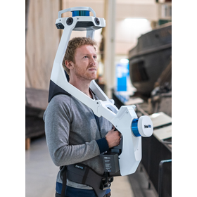
【Smart 3D Survey】 ■Data Format Import: Laser Point Cloud (LAS), MDB, TXT Export: Laser Point Cloud (TXT, LAS, DXF, PTS), Images (TIFF, PNG, JPG, Georeferenced bitmap) CAD (DXF) ■Operating Requirements CPU: Core i7 4GHz or higher Memory: 16GB or higher Graphics Card (Video Memory 1GB or higher) 【VLX】 Dimensions (Height x Width x Depth): 108 × 33 × 56 cm Weight: 9.3 kg Number of Laser Scanners: 2 units × 16 layers Range: Maximum 100m Point Cloud Acquisition Speed: 2 units × 300,000 points/second Camera Resolution: 4 units × 20 megapixels Relative Accuracy of Point Cloud: 8mm Point Cloud Formats: E57, LAS, PTS, XYZ, PLY
Price information
【S3S】Subscription contract 100,000 yen/year (excluding tax)
Delivery Time
Model number/Brand name
Smart 3D Survey
Applications/Examples of results
Importing data such as 360° photos, point clouds, MMS, CAD, handheld measuring devices, UAV, and WEBMAP.
catalog(4)
Download All Catalogs


Distributors

In April 2016, Asco Co., Ltd. and Daito Design Consultant Co., Ltd. merged and started operations. Since our establishment, we have contributed to society as a comprehensive construction consultant involved in everything from research and planning to design for the development of various social infrastructure. This management integration has strengthened our business foundation, allowing us to respond to the demands of the times and tackle challenges through advanced and diverse business development. Currently, our country faces various challenges such as declining birth rates and an aging population, a shortage of workers in the construction industry, the aging of social infrastructure, increasing disaster risks, as well as the conservation of the natural environment and regional revitalization. In this environment, Asco Daito aims to be a company that plays a part in the development of social infrastructure, under the philosophy of "Responsibility, Happiness, Continuity" towards products, services, society, and families. We are committed to making further efforts to address the increasingly diverse and complex needs by focusing on the following three areas and striving to become the number one consulting firm: "Providing services that protect infrastructure stock and realize a sustainable society." "Offering services that assist in disaster prevention, mitigation, and recovery, protecting the land and people from natural disasters." "Providing asset management that contributes to the sound management of diversifying infrastructure."