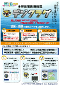
[Wave Forecast Information] Weather and Ocean Conditions Comprehensive Portal Site Compass PLUS


Centralized management of oceanographic information such as wave height and wind speed in the cloud! For safety measures and project management in port construction and maritime transportation.
The 【Meteorological and Oceanographic Comprehensive Portal Site Compass PLUS】 NETIS registration number QSK-210001-VE quickly and accurately predicts oceanographic information for all areas of the Japan Sea (N23°~N46°, E120°~148°) up to 10 days in advance with a 1km mesh resolution. You can easily register up to 20 locations at any time, allowing for remote monitoring of oceanographic information for multiple locations via the cloud. 【Features】 ■ Quick and accurate oceanographic predictions (significant wave height, wave direction, period, wind speed, rainfall, heat index (WBGT)) for up to 10 days at 1km mesh intervals ■ Up to 20 locations can be registered and viewed ■ Observation of significant wave height - Option 【Digital Jellyfish】 ■ Weather observation and prediction for construction sites - Option 【N Sensor】 ■ Information display and alarm display using electronic bulletin boards and rotating lights - Option 【Disaster Prevention Light】 ■ Viewing of still images and live video from cameras - Option 【Web Camera】 ■ Water level observation with battery-operated water level gauge - Option ■ Viewing of typhoon information *For more details, please refer to the PDF document or feel free to contact us.
basic information
【Specifications】 ■ Short-term (3-day) forecast, Long-term (10-day) forecast ■ Accessible from various devices such as computers, tablets, and smartphones. Supported browsers: Microsoft Edge, Google Chrome, Safari. *IE is not supported. [Options] ■ Save past forecast data ■ Tidal information ■ Route forecast ■ Forecast email delivery (PDF attachment) ■ Add account
Price information
Online estimates are now available from the homepage.
Delivery Time
Applications/Examples of results
Harbor construction, ferry company, offshore wind power construction, caisson installation work, creativity and ingenuity, technical proposals.
catalog(6)
Download All Catalogs


News about this product(20)
-

The 56th Iwasaki Total Solution Fair 2026 has successfully concluded.
The booth exhibition of Sysmet Co., Ltd. at the 56th Iwasaki Total Solution Fair 2026, held on April 8 (Wednesday) and April 9 (Thursday), has successfully concluded. On the day of the event, members of the technical department involved in meteorological forecasting, equipment development, and fieldwork from our headquarters in Kitakyushu participated to support the booth, which included actual equipment. Many visitors came to the booth, where they asked questions to the meteorologists and inquired about new services such as environmental sensors for noise and vibration, resulting in a great response. On the 8th, we were honored to have the opportunity to give a presentation on "How to View Meteorological Data from a Forecaster's Perspective and an Introduction to AI Wind Forecasting" at the mini stage, led by our meteorologists. Moving forward, we will continue to provide services that contribute to everyone's safety and efficiency, focusing on the theme of "Visible" safety created through the combination of meteorology and technology.
-

Meteorological Helpful Information "Danger Warning" Added - New Disaster Prevention Meteorological Information in Five Levels - Supervised by Sysmet Co., Ltd. Meteorologist
On November 11, 2025, a proposal to revise the "Disaster Prevention Meteorological Information" concerning floods, heavy rain, landslides, and storm surges was approved by the Cabinet. The implementation is scheduled for the rainy season in 2026. This article will explain what disaster prevention meteorological information is, the issues with the current system, and how the new disaster prevention meteorological information will change. Table of Contents 1. What is disaster prevention meteorological information? 2. Issues with the current disaster prevention meteorological information 3. How will the new disaster prevention meteorological information change? 1. What is disaster prevention meteorological information? Disaster prevention meteorological information refers to information related to disaster risks announced by the Japan Meteorological Agency. It is issued when the risk of disasters such as heavy rain, floods, strong winds, lightning, storm surges, and landslides increases, serving as a basis for decisions on evacuation and work suspension. Specifically, it includes alerts and warnings such as "Special Heavy Rain Warning," "Landslide Warning," and "Storm Surge Advisory," which are denoted by the suffixes "warning" or "advisory." It also encompasses various other information, such as "Meteorological Information on Significant Heavy Rain" that alerts to the risk of linearly organized precipitation bands, "Heat Stroke Warning Alerts" during summer, and "Typhoon Information." 2. Issues with the current disaster prevention meteorological information For details, please visit our website.
-

Let's post the ZEROSAI and Compass PLUS login information poster at the workplace! Sharing weather and oceanographic information within the workplace!
Thank you very much for always using our products. We have created a "Login Promotion Poster" that contains the login information to help you make the most of our products, the "Natural Disaster Prevention System ZEROSAI" and the "Weather and Ocean Comprehensive Portal Site Compass PLUS." *For more details, please visit our website or feel free to contact us.
-

[Weather Useful Information] Can satellite images show the strength of cold air above? What is "offshore distance"? Supervised by Sysmet Co., Ltd. Weather Forecaster.
Thank you for always watching. The last weather-related information for 2024 will introduce a theme unique to winter. As December has arrived, the temperature has dropped significantly. During this time, the term "cold air aloft" is often heard in weather forecasts. The phenomena of cold air aloft and clouds observed by the Himawari weather satellite can be viewed as images on the Japan Meteorological Agency's website. In fact, those images contain indicators that suggest the strength of the cold air aloft, in addition to the movement and shape of the clouds. This is referred to as "offshore distance." This time, I would like to introduce this "offshore distance." It may sound like a difficult term that is not very familiar, but it can actually be easily checked. Table of Contents 1. What is offshore distance? 2. Offshore distance and the strength of cold air aloft 3. Conclusion *For more details, please visit our website or feel free to contact us.
-

What is the "utilization coefficient" used in port construction for those involved in marine construction?
Thank you for always watching. This time, I will talk about important indicators used in port operations. Depending on the site environment, offshore construction is easily affected by waves and wind, and it is particularly necessary to carefully consider weather conditions in cost management and labor management. For this reason, there is an important keyword in offshore construction known as "utilization coefficient." This time, we will take a rough look at this "utilization coefficient." 1. What does "utilization" mean? 2. Calculation of the utilization coefficient 3. Concept of the utilization coefficient 1. What does "utilization" mean? First, "utilization" refers to the state in which machinery and equipment have been delivered to the construction site. The number of days from when the equipment is delivered to when it is removed is called "utilization days." Additionally, the construction period (excluding preparation and cleanup) includes not only the days when work is performed (operating days) but also non-operating days (holidays, safety training days, days of inclement weather, etc.). The remaining days in a year (365 days) after excluding these non-operating days constitute the annual "operating days" for the machinery and equipment. *For more details, please visit our website or feel free to contact us.
Distributors

Sysmet Corporation, as a comprehensive weather consulting firm, provides accurate information and the latest information systems to solve problems for various companies, utilizing experienced engineers and the latest technology. Weather and oceanographic information is essential for protecting human life from danger and preventing material and human losses. By obtaining highly accurate weather and oceanographic information, businesses can quickly implement risk avoidance and disaster preparedness measures. We are committed to research and development and quality improvement to meet the needs of all companies, including weather and oceanographic forecasting, system development, and weather and oceanographic observation and analysis.


