[Product Useful Information] Compass PLUS Convenient Ways to Use Forecast Distribution Maps


Display the distribution of wave height, period, wave direction, wind speed, wind direction, and particle lines all at once on the map! Ocean conditions, wave height, typhoon, severe weather risk, DX, ICT, remote monitoring.
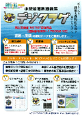
Introducing the convenient features of 【Compass PLUS】 that can visualize oceanographic information. Please make use of it for oceanographic DX. Convenient Feature: Prediction Distribution Map The prediction distribution map displays the distribution of wave height, period, wave direction, wind speed, and wind direction on a map, along with particle lines. For up to 72 hours ahead, it shows data every 3 hours, and for more than 72 hours up to 10 days ahead, it displays data every 12 hours in an animated format. - Coastal Wave (CWM): Displays the latest initial values every 3 hours up to 72 hours ahead - Global Wave (GWN): Displays the latest initial values every 12 hours up to 264 hours ahead
basic information
For details, please check the link below! https://product.sysmet.jp/bousaiban/k_88.html
Price information
Please contact us.
Delivery Time
Applications/Examples of results
Wave height observation, offshore construction, port construction, wave height survey, technical proposal, creativity and ingenuity, trial construction with weather risk settlement type.
catalog(2)
Download All Catalogs
News about this product(1)

Distributors

Sysmet Corporation, as a comprehensive weather consulting firm, provides accurate information and the latest information systems to solve problems for various companies, utilizing experienced engineers and the latest technology. Weather and oceanographic information is essential for protecting human life from danger and preventing material and human losses. By obtaining highly accurate weather and oceanographic information, businesses can quickly implement risk avoidance and disaster preparedness measures. We are committed to research and development and quality improvement to meet the needs of all companies, including weather and oceanographic forecasting, system development, and weather and oceanographic observation and analysis.


