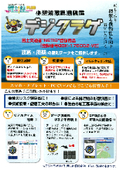
【Product Useful Information】 Compass PLUS Convenient Ways to Use Forecast Distribution Maps Display wave height, period, wave direction, wind speed, wind direction distribution, and particle lines all at once on the map! Ocean conditions, wave height, typhoons, severe weather risk, DX, ICT, remote monitoring.
シスメット 本社/福岡県北九州市 ・東日本オフィス/埼玉県入間市 ・北日本オフィス/北海道札幌市
Introducing the convenient features of 【Compass PLUS】 that can visualize ocean conditions. Please make use of it for ocean condition DX. Convenient Feature: Forecast Distribution Map The forecast distribution map displays wave height, period, wave direction, wind speed, and wind direction on a map, along with particle lines. It shows animations every 3 hours up to 72 hours ahead and every 12 hours for up to 10 days ahead. - Coastal Wave (CWM): Displays the latest initial values every 3 hours up to 72 hours ahead. - Global Wave (GWN): Displays the latest initial values every 12 hours up to 264 hours ahead. For more details, please check the link below! https://product.sysmet.jp/bousaiban/k_88.html


Related Links
Related product information

Related catalog